

Skrevet av: Ann Helen Paulsen: Translator Jesper Villadsen
Dato: 08.03.2008 17:21
 New trail from Lævnasjav’ri is not in the GPS map which you find on the website.
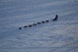
When the mushers come to Lævnasjav’ri, about 35 kilometers from the checkpoint in Jotka, the trail goes south. The trail does not follow the route drawn on the map. This will make it look like the mushers have lost the trail. The mushers come back on the drawn trail about five kilometers from the checkpoint in Skoganvarre. After Skoganvarre there are no more irregularities in the route.